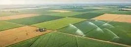
Terrain, canal and crop maps that show where water goes and where it stalls.

What keeps you up at night
The problems we are asked to solve most often in agriculture.
- 01
Fields are levelled unevenly.Water pools or runs off.
- 02
Canal and watercourse layouts do not match the slope.
- 03
Crop health and water stress are found too late.
- 04
Holding boundaries are unclear for subsidies or loans.
- 05
Floods wipe fields, and there is no damage map for claims.
- 06
Survey costs too much per acre for small holdings.
What we do about it
6 capabilities, one team, one coordinate system from field to dashboard.
- GeoAI & Satellite IntelligenceVegetation classification and crop health indices.Know what changed on your land, and where, without sending a team.
- Terrain Engineering & EarthworkContours, slope and levelling volumes.Cut and fill volumes both sides of the contract accept.
- Watershed & Hydrological EngineeringCatchment, runoff and irrigation drainage.Know where water goes before you build in its way.
- Drone Survey OperationsField orthomosaics.A current, measurable picture of your site, flown on your schedule.
- Change Detection & MonitoringFlood damage and crop change.See every new structure, cut and encroachment between two dates.
- Intelligent GIS DashboardsA panel per farm or canal scheme.Every layer, every date, in one panel your team can use.
Hydrology, on your ground.
Rising water on the field DEM; field boundaries highlight where water pools.
What lands on your desk
Files you can open, check and forward. Each delivery states its method and measured accuracy.
- Field DEM and levelling cut / fill planGeoTIFFDEMPDF
- Canal and watercourse slope profilePDF
- NDVI / vegetation index rasterGeoTIFF
- Flood damage map per fieldPDFGPKG
- OrthomosaicGeoTIFF
- Dashboard layer per farm or schemeGPKGURL
The numbers
Published figures, each with its source and date. Estimates are marked.
33 million
people affected by the 2022 floods
Government of Pakistan estimate, September 2022.
Sep 2022ReliefWeb · Pakistan floods fact sheet (opens in a new tab)
2 million+
houses destroyed or damaged in the 2022 floods
About 767,000 destroyed and 1.3 million damaged (OCHA, October 2022).
Oct 2022OCHA · Revised Pakistan 2022 Floods Response Plan (opens in a new tab)
Send us a boundary. We'll send back intelligence.
A KML, a sketch on a map or a district name is enough to start.
We reply by email with questions, a method and a delivery list.